Aiguillette des Houches – Chamonix Hikes
A very pleasant day-hike, the Aiguillette des Houches nonetheless provides a stiff climb that is rewarded with a fantastic view.
Like the Aiguillette des Possettes at the opposite end of the valley, the Aiguillette des Houches is also a great day hike with splendid views across the Mont Blanc Massif. This one is perhaps a little longer, although it does depend where you start from.
Stats:
Distance: 15km
Altitude gain/loss: 1300m
Time: around 6-7 hours hiking
Shorter options are possible
Grading: Physical![]() Technical
Technical ![]()
Similar routes: Aiguillette des Possettes, Lac Blanc
Harder routes: La Jonction
Aiguillette translates as little needle, and as with Possettes, this little needle is also a good variant on the Tour du Mont Blanc. Both options add a relatively small detour to find some interesting terrain. The Aiguillette des Houches lies at the South Western end of the Chamonix Aiguilles-Rouges range, giving good views across the lower Arve valley. Both Aiguillettes are among the few summits in the area that can be reached without using either ski lifts or mountaineering equipment.
If you want to organise a guided trek to the Aiguillette des Houches, send us a message or have a look at our guided Classic Chamonix Hikes page.
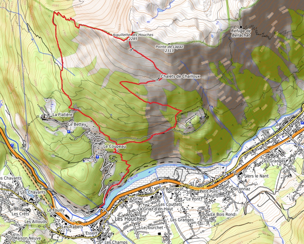
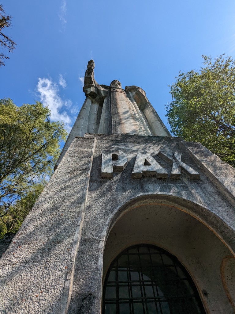
If you are using public transport, the best starting point is Les Houches railway station. Arriving by car lets you shorten the route by parking higher up at Le Bettey or Parc Merlet. From the railway station, turn left and follow Route de Coupeau until it turns left and crosses the railway. Then turn right and take the minor road to a parking area. Fork left and follow signs up the hill towards Christ Roi. This impressive and incongruous statue stands opposite Les Houches. Perhaps surprisingly, the statue functions as a church with a pulpit inside its base and occasional services. The building just across the clearing houses an enormous church bell.
Merlet Animal Park
From here, take the paths up and then rightwards to reach the parking area for the Merlet Animal Park. The animal park itself is worth a visit. It’s the easiest way to see marmots, ibex or chamois in their natural habitat without having to rely on luck. It’s probably best to save it for a different day though, as you still have a long way to hike today.
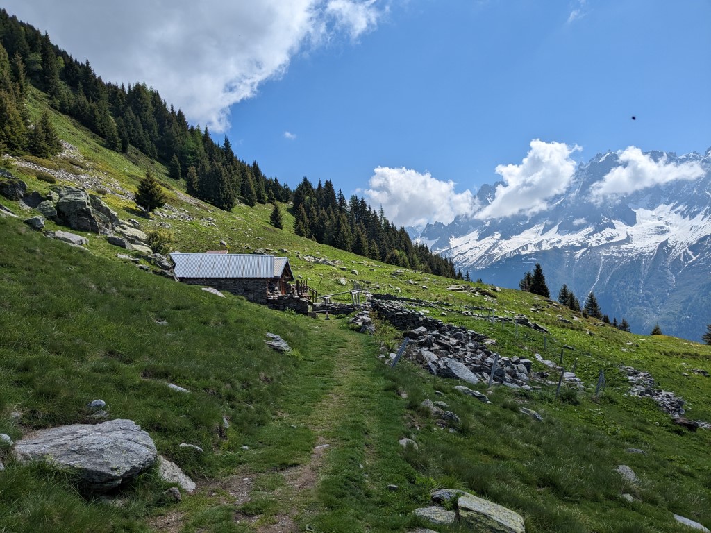
From Merlet, keep climbing through the forest. After skirting the Animal Park, take the high path on the left signposted Chalets de Chailloux. At the chalets, the path finally emerges from the trees and into open pastures. The Chailloux buvette is the only refreshment stop we’ll pass on this route, so it’s a good opportunity for a break before the final 300 metre climb to the summit.
A question of names
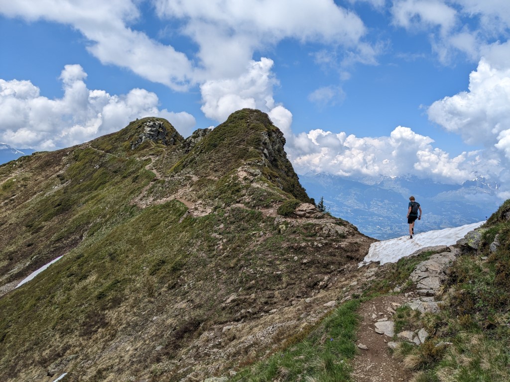
The path heads right then left before steep zig-zags lead to the top at 2285m. This whole ridgeline is usually referred to as the Aiguillette des Houches, but in fact there are two higher points on it, the 2313m Pointe de Lapaz and the 2310m Aiguillette du Brevent. If you want to visit these, a one-kilometre stroll along the ridge will take in both of them, plus another kilometre back.
Returning to the summit, we suggest descending the south-west ridge as far as Pierre-Blanche at 1697m. This path is airy and exciting, but not too difficult. The reward is a fantastic view over the rocky walls of the Rochers des Fiz and the Pointe de Platé. At Piere-Blanche, turn left and traverse in a long diagonal to eventually meet the ascent path just above the Christ-Roi statue. From here, follow the route you used earlier in the day to arrive back at the railway station.
Aiguillette de Houches Variations
If you’re doing the Aiguilette as part of a clockwise Tour du Mont Blanc, you’ll want to turn right at the top and follow one of the paths to Belachat. From here you rejoin the standard route up to Le Brevent. If you’re doing the standard anti-clockwise TMB route, you’ll climb the Aiguillette from Belachat and follow our route in reverse to descend.
If you want a longer day, you can start from Chamonix and hike up via Belachat, or you can turn right instead of left at Pierre-Blanche on the descent and visit the Chalets du Fer. The latter is the remnant of iron mining in the area.
Whichever way you climb it, the Aiguillette des Houches is a lovely little mountain on the very edge of the Chamonix ranges. We’d highly recommend it for a good hike in the Chamonix valley.