
Aiguillette des Posettes – Chamonix Hikes
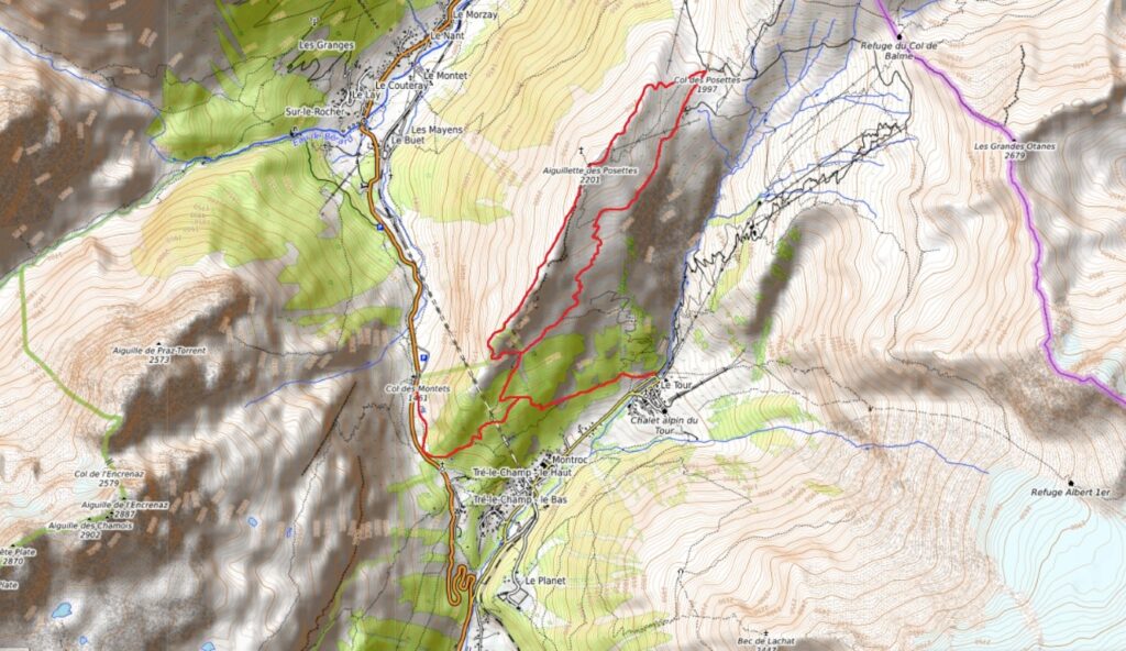
The Aiguillette des Posettes stands at the head of the Chamonix valley, dividing it into two branches. One leads to Le Tour, culminating in the Col de Balme. The other winds up over the Col du Montets before descending to Vallorcine and the Swiss border. Between these two branches, the sharp ridgeline of the Posettes Arete leads to the summit of the Aiguillette. As well as being a fine hike in its own right, the Posettes Arête makes a classic variation on the standard Tour du Mont Blanc route.
Stats:
Distance: 11km
Altitude gain/loss: 800m
Time: around 4 hours hiking
Grading: Physical![]() Technical
Technical ![]()
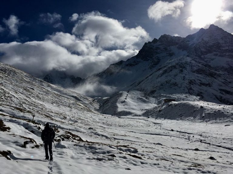
On the whole, the trek up the arete is varied and interesting but not too difficult. On reaching the summit, you’ll find the airy ridge gives way to a small plateau with spectacular views. The descent takes in the Col des Posettes before returning along the flank of the Aiguillette. The Alpage de Balme restaurant is a great place to stop for lunch on the way down. After this the path skirts around old slate quarries before dropping into the trees to rejoin the ascent path.

Starting out
We usually start from the Col des Montets where there are a few parking options near the visitor centre. Take the path on the east side of the road, on the Chamonix side of the col. That’s the right-hand side as you arrive from Chamonix. Paths from the different parking areas meet quite quickly at a signpost. From here you can head uphill following the signs for the Aiguillette des Posettes. Take care as the path is steep and strewn with tree roots.
If you’re travelling by public transport, you can take the bus to the Balme/Le Tour gondola station instead. Look for the path at the top of the car park, to the left of the lift station and follow this to meet the path from the Col des Montets.
Leaving the trees
Keep climbing until the trees start to thin, and go left at a junction, again following signs for the Aiguillette des Posettes. The trees get smaller and gradually disappear until you are following a steep path through rocks. There are sections with steps to get up the more difficult parts.
This is where the views start to get better and better, so take a moment to look around. As you climb the gradient eventually eases off, but the summit is still further away than you think. Although a little airy, the ridge is never narrow enough to feel scary. It is uneven and rocky though, so you need to be reasonably comfortable on steeper ground.
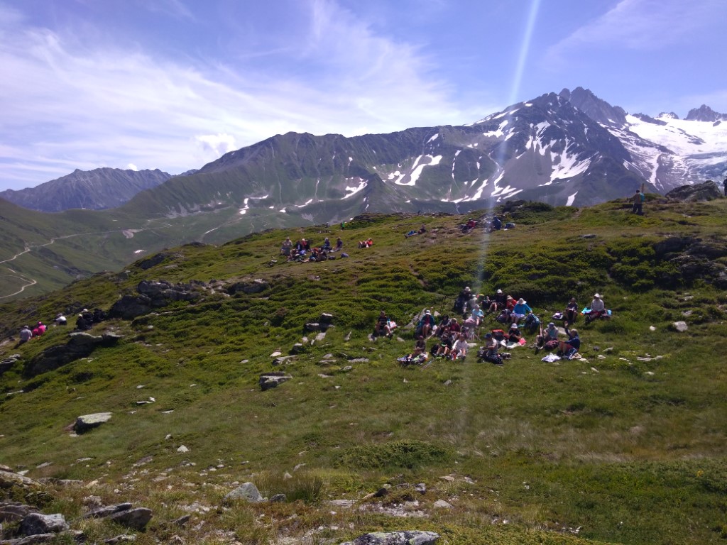
The Aiguillette des Posettes summit
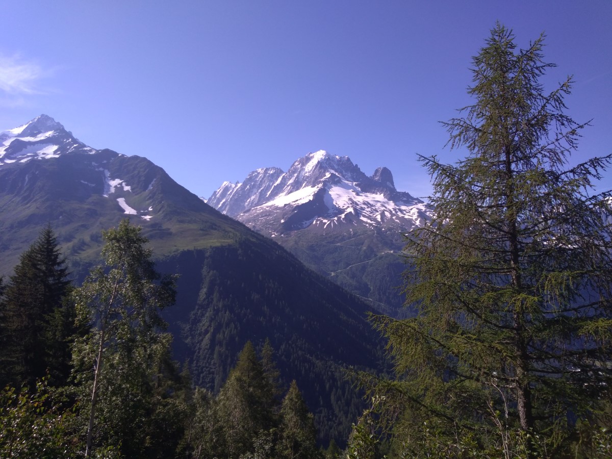
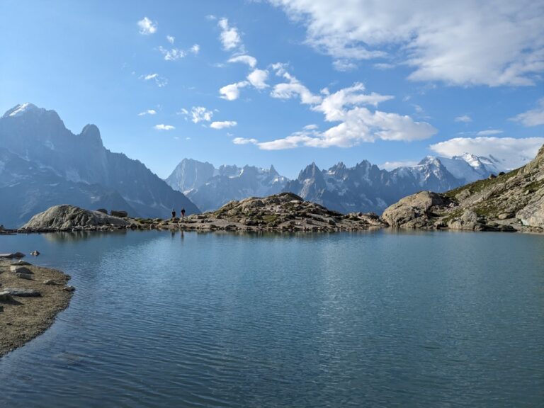
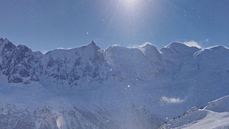
After a few false summits, you arrive at the summit plateau. In our opinion, this is one of the best viewpoints you can hike to in the Chamonix valley. By hiking, we mean that you can get there on foot, without either cable cars or mountaineering equipment. As well as Mont-Blanc, you can see the Aiguille Verte and the Drus, the Aiguille du Chardonnet, the Tour glacier, the Aiguille du Tour, The Aiguilles Rouges and Mont Buet across the valley, and the Emmosson Dam in Switzerland.
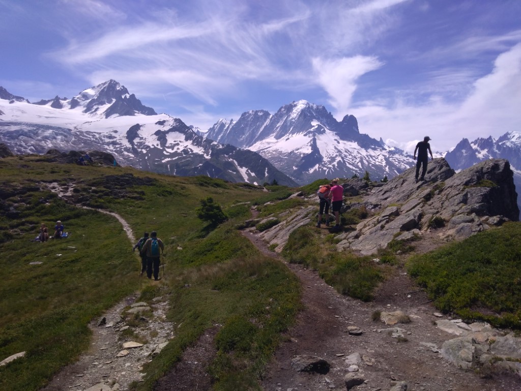
Heading down
After stopping for a while on the summit, continue north-east to descend to the Col des Posettes. At the col, take a sharp right onto a good path leading past the Alpage de Balme farm and restaurant.
This collection of rustic buildings is home to one of the finest mountain restaurants in the valley. It’s a great place for lunch but be sure to book ahead both summer and winter. It gets busy, and with good reason. The menu is full of local specialties from both sides of the nearby Swiss border. You can get French mountain dishes like Tartiflette or Croute Savoyarde, alongside Swiss classics like Rosti.
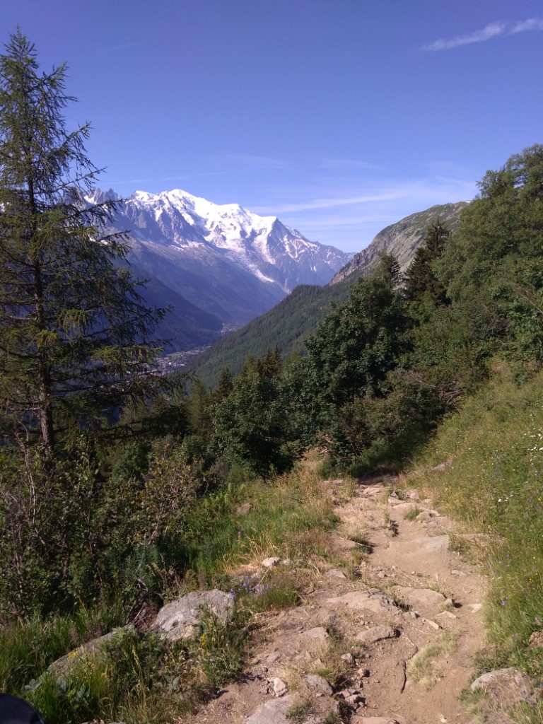
After the Chalets, the path climbs slightly to cross a ridge, then descends through remnants of slate workings. Just above the tree line, you re-join the ascent route and follow this back to the start. Take extra care of the roots when descending. More than one person has taken a tumble here in the past.
Aiguillette des Posettes summary
The Aiguille de Posettes hike is great for a day out at an easy pace, or for a half-day of harder hiking. Unlike most hikes in the Chamonix valley, you can reach a great viewpoint without lift assistance and without too much of an uphill climb before you reach the treeline. The summit is a popular picnic spot and there is also a good mountain restaurant near the start of the descent. It is a great hike for teenagers and older children, but not suitable for younger kids. The path is often steep, with roots in the forest and rocks higher up. And the summit is one of the best viewpoints in the valley that can be reached without a cable car or mountaineering kit.
Get in touch to book a private guide for the Aiguillette des Posettes, or any other local hike, or if you’re looking for more information. And take a look at our trekking pages to see what trips and group activities we have planned.
You can read some of our other Mont-Blanc trekking articles here for more Chamonix hiking inspiration.

One Comment