Le Grand Balcon Nord - Randonnée à Chamonix
Along with Lac Blanc, the Grand Balcon Nord is one of the must-do day hikes of the Chamonix Valley. The cable car access lets you get high into the mountains with relatively little effort, taking you straight to awe-inspiring views and a great mountain ambience.
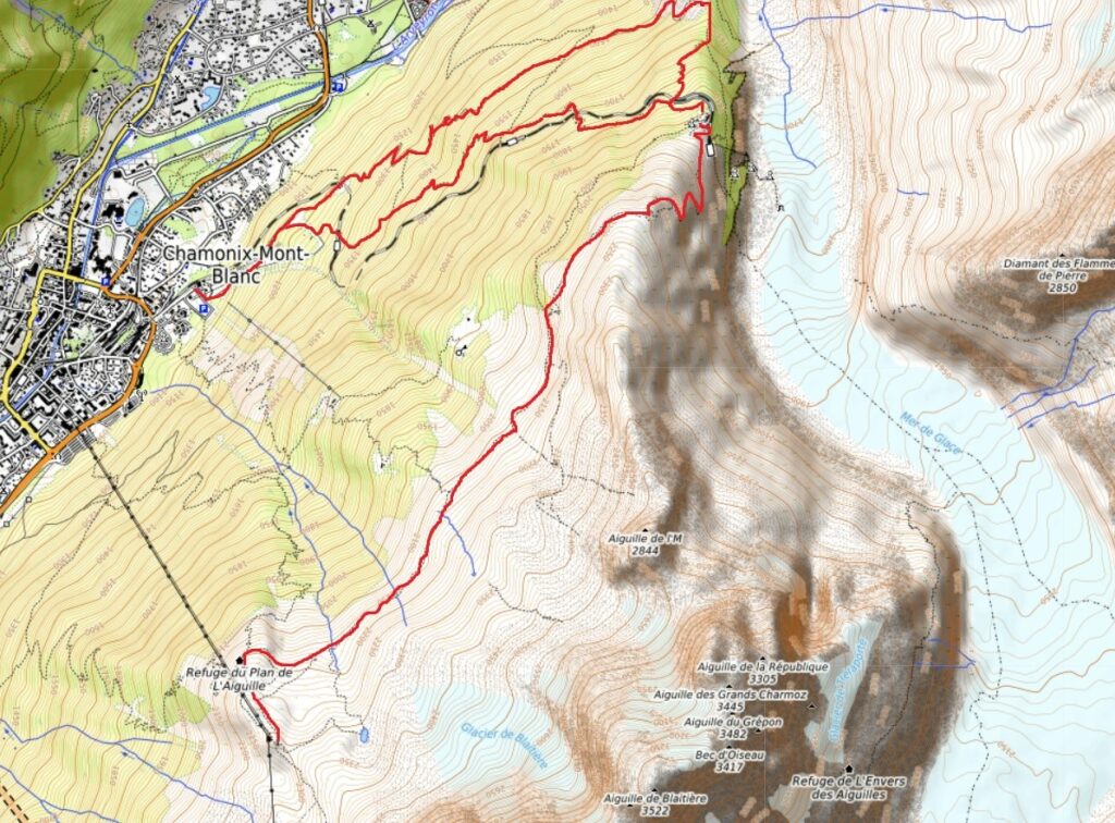
Stats (starting from Plan de l’Aiguille)
Distance: 6.5km to Montenvers, 12km to Chamonix
Ascent: 140m
Descent: 530m to Montenvers, 1400m to Chamonix
Time: 2-3 hours to Montenvers, about 4 hours to Chamonix
Grading: Physical![]() Technique
Technique ![]()
The hike starts with a trip up the Aiguille du Midi cable car to the Plan de l’Aiguille mid station. The complete trip to the top station shouldn’t be missed. You can do it on the same day if you are a moderately good hiker, or on another day if you prefer a more relaxed pace. We normally take in the Grand Balcon Nord on our Semaine de randonnée en été à Chamonix et Semaine de randonnée de septembre à Chamonix trips.
Starting the Grand Balcon Nord
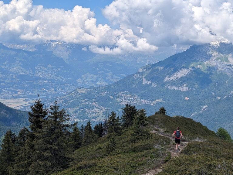
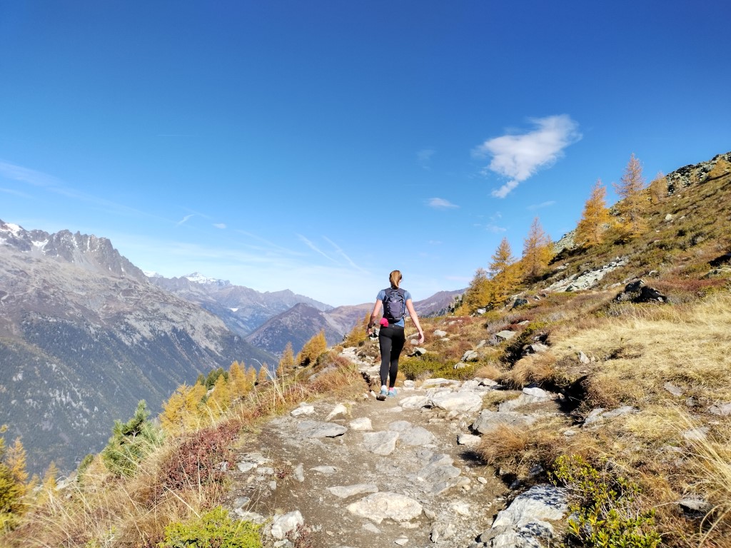
From the cable car station, descend towards the Plan de l’Aiguille refuge – a great spot for lunch or refreshments although still early in the walk. Then bear right to follow the popular balcony path. Although it doesn’t gain or lose much height, there is a lot of undulation so the going is slower than you might expect. You a firmly in the world of the high-Alpage here. Below are steeply forested hillsides. Above you, sparsely vegetated moraine walls guard the granite needles of the Chamonix Aiguilles.
After a couple of kilometres, a path on the left is signposted towards Blatiere Alpage. This is one of the numerous small cheese producing farms that still nestle amongst the high pastures of the Alps. The path to the Alpage is another worthwhile route, but for the Grand Balcon Nord we continue straight ahead. All along this path there are views northward to the Aiguilles Rouges on the far side of the Chamonix valley. Perhaps confusingly, the Balcon Nord is named because it faces north. It is actually on the south side of the valley.
Climbing to Signal Forbes
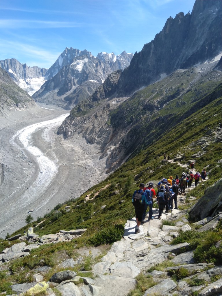
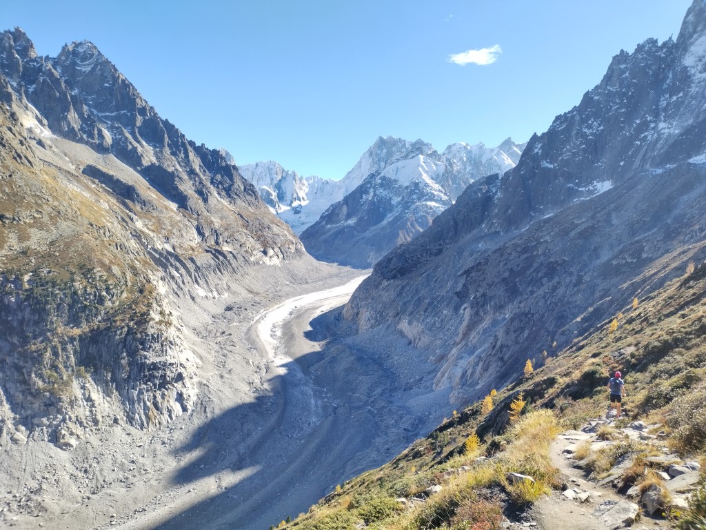
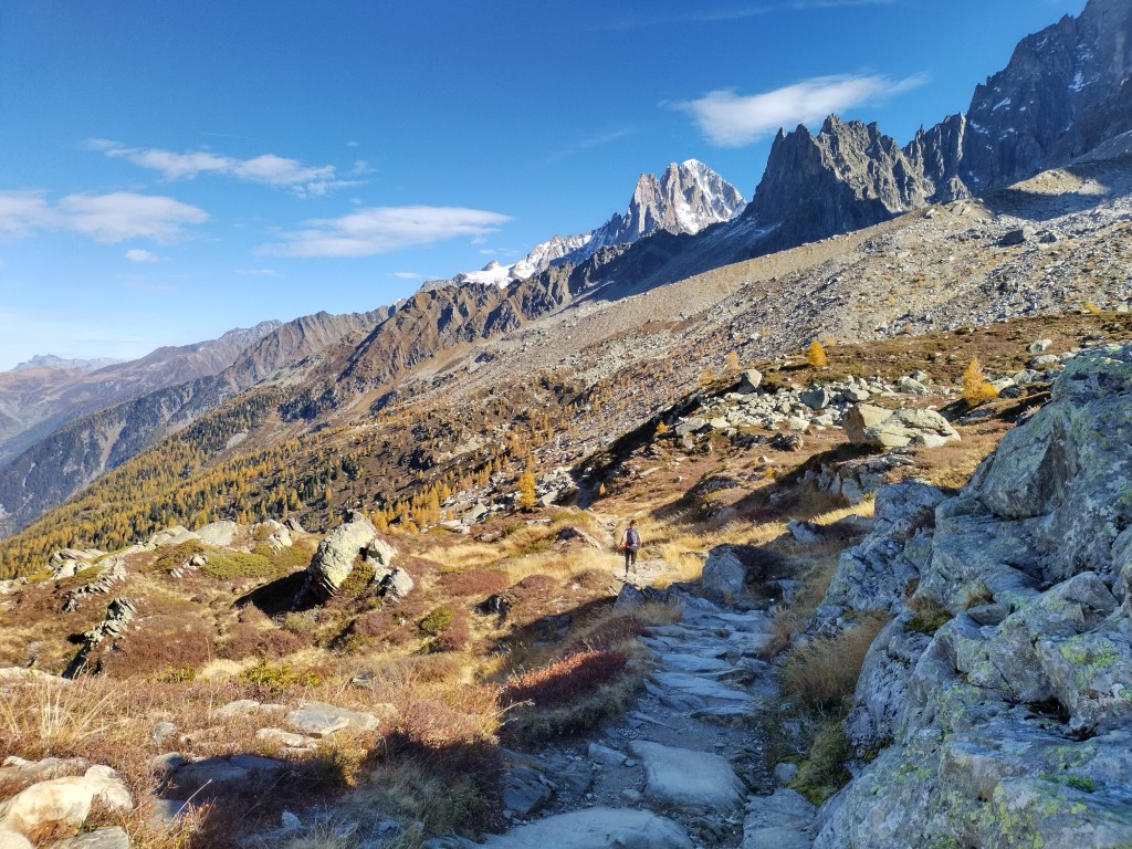
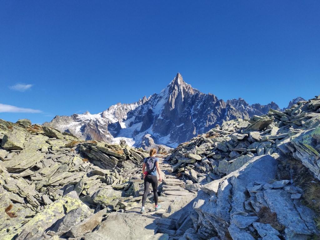
Passing below the north face of the Aiguille de l’M, so called because it looks like a giant version of that letter, you reach a junction. Both paths lead to the same destination, Montenvers station. The lower route enters the trees and is shorter with less climbing. But we highly recommend taking the higher path on the right. This climbs to the ridge on the right to reach Signal Forbes. From here you are met with a sudden and spectacular view of the Mer de Glace glacier far below you.
While you are at the Signal Forbes, it is worth pointing out the Forbes’ Bands on the glacier. These curved light and dark stripes across the glacier were first described by Scottish geologist James David Forbes in the 19eme century. One dark and one light band together indicate the distance travelled by the glacier in a year.
On the far bank of the glacier, the Drus and the Aiguilles Vert dominate the view. With all the spectacular mountain scenery on offer, don’t forget to look where you are placing your feet. The path, though popular, is uneven and crosses precipitous terrain.
Montenvers
Staying above the Mer de Glace, the path zig-zags its way down to Montenvers. Perched high on a ridge above Chamonix, Montenvers hosts a hotel, restaurant, mountain railway station, museums and a cable car down to the ice caves in the glacier itself. From here you can either take the train down the cog-railway to Chamonix. Alternatively, if you’re feeling energetic, you can walk down one of the several paths through the woods. If you are going to walk down, I’d recommend going via the Mottets buvette – a delightful little snack bar at a little over 1600m. If you take the regular path down, close to the railway line, there is also a snack bar halfway down at Caillet. There is no shortage of refreshment options in the Chamonix hillsides.
Allow about two or three hours walking at a leisurely pace to get from Plan de l’Aiguille to Montenvers, then another hour and a half for the descent to Chamonix. You can buy a combined ticket for the cable car and train, if you plan to take the train down.
If you want to make a (much) bigger day of it, you can hike up to Plan de l’Aiguille instead of taking the cable car. This adds around three hours to the total time, with 1100 metres of additional climbing.
Grand Balcon Nord Summary
The Grand Balcon Nord is a classic Chamonix day hike which can be done as part of a leisurely day or as a brisk afternoon hike. It can be extended if you are looking for a more challenging route, but the cable car and train make it an accessible route for hikers of all levels, including children. That said, the terrain is uneven and the mountain environment can be unpredictable at over 2000 metres above sea level. Check the weather forecast and be prepared.
Contactez-nous if you want a private guide to organise and lead your Grand Balcon Nord trek. Or have a look at our trekking pages to see what group trips and activities we have scheduled.
You could also read our other Mont-Blanc hiking articles for more inspiration.